

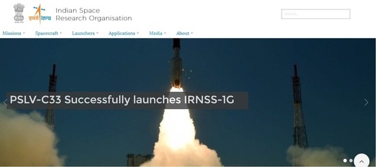
India is set to get its own version of Global Positioning System (GPS) called the Indian Regional Navigation Satellite System (IRNSS), after the launch of the 7th IRNSS satellite by the Indian Space Research Organization (ISRO) yesterday. The new satellite—IRNSS-1G—completes the entire cluster of the independent regional navigation system, which was first initiated in July 2013. ISRO claims that the IRNSS is designed to provide position information of the entire country and around 1500km around the Indian mainland (boundaries). It also claims that the IRNSS will offer accurate position information to users in India with a position accuracy of better than 20 metres in these areas. A ground facility has also been setup by ISRO across 18 different locations in the country, which will be responsible for satellite ranging and monitoring, generation and transmission of navigation parameters, etc., The IRNSS-1G is the seventh navigation satellite to be launched out of the 7 satellites constituting the Indian Regional Navigation Satellite System. ISRO says that IRNSS-1A, 1B, 1C, ID, IE and 1F, the first 6 satellites of the project, were launched in July 2013, April 2014, October 2014, March 2015, January 2016 and March 2016, respectively. Services: The IRNSS will offer two type of services namely Standard Positioning Services for all users and Restricted Services (RS) which will be provided only to authorized users. Other applications of IRNSS include aerial and marine navigation, disaster management, vehicle tracking and fleet management, Search and Rescue (SAR) operations, Mining and Surveying and other Mapping operations. Gagan project…